Map of Texas map
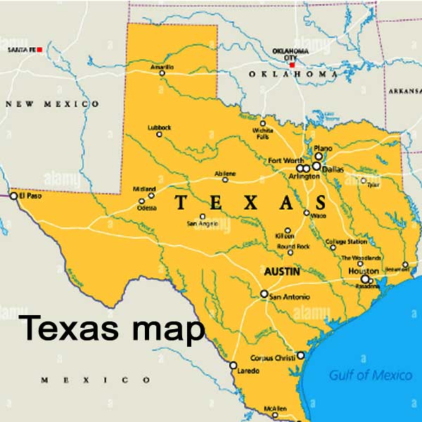
As of 2023, Texas has a population of over 30 million people, making it the second-most populous state in the country. The state is divided into several regions, including North Texas, East Texas, Central Texas, South Texas, West Texas, and the Panhandle. Its size is approximately 68% larger than California, covering an area of 268,597 square miles. Despite its vast size, Texas has a relatively low population density, with most of the population concentrated in major cities and urban areas.
Texas is home to several major cities and landmarks, including the state capital of Austin, Houston, Dallas, San Antonio, and El Paso. The state is also home to several national parks and forests, including Big Bend National Park, Guadalupe Mountains National Park, and the Davy Crockett National Forest. Other notable landmarks include the Alamo, the Space Center Houston, and the San Antonio River Walk. The state's major cities are connected by a vast network of highways and interstates, making it easy to explore all that Texas has to offer.
Texas is divided into three distinct regions, each with its unique physical and cultural characteristics.
 |
| Texas map |
The Coastal Plains region is located in the eastern part of the state and is characterized by its flat, low-lying terrain. This region extends from the Gulf of Mexico to the Balcones Escarpment, which separates it from the Great Plains region to the west.

Houston map


The Coastal Plains region is home to many important cities, including Houston, Corpus
Christi, and Galveston. The region's economy is driven by industries such as oil and gas, agriculture, and tourism.

USA MAP


Comments
Post a Comment